GR2Analyst processes each radar volume and derives five high resolution 2D products from base reflectivity:
The high resolution derivative products are calculated on 1km x 1° x 230km grid with 256 data levels. They automatically account for the current storm motion vector setting and are recalculated when the vector is changed. In addition, the POSH and MEHS algorithms use GR2Analyst's environmental database of 0C and -20C heights. You need to enter these temp/heights accurately in order to get correct hail algorithm results. The algorithm uses any temp/height data within 48 hours of the volume scan time. If no recent data is found, it defaults to 10,000ft and 20,000ft for the heights.
The following examples use Level II and Level III data from KTLX of the near-record setting hailstorm in Velma, OK on May 14, 2003 at 0823Z.
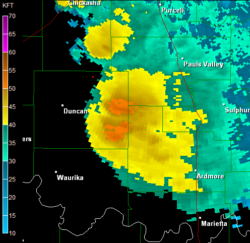
GR2Analyst's Echo Tops product interpolates between tilts to find the echo tops dbz height. The echo tops dbz defaults to 18.5 but is user-selectable. Here is ET from GR2Analyst for the Velma, OK hailstorm:
You see well-defined storms with overshooting tops. Here is the corresponding Level III product as rendered by GRLevel3:
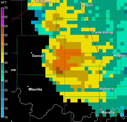
The loss of detail in the Level III product is significant, rendering it almost useless for detailed analysis.
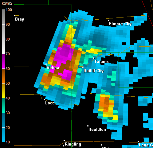
GR2Analyst's VIL product integrates the reflectivity vertically to estimate the liquid water content of a cell. The traditional VIL calculation caps the reflectivity values at 56 dbz in order to reduce the contribution of hail. GR2Analyst's VIL algorithm defaults to 56 dbz but is user-selectable. Here is VIL from GR2Analyst using a 56 dbz cap for the Velma, OK hailstorm:
Here is the Level III VIL product as rendered by GRLevel3:
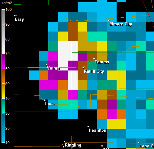
GR2Analyst's VIL display is far more detailed.
GR2Analyst is the only commercially available application that derives a graphical MEHS product. It implements the NSSL algorithm described by Stumpf, et. al. in An Enhanced Hail Detection Algorithm for the WSR-88D but on a radial grid instead of as a cell-centroid point product.
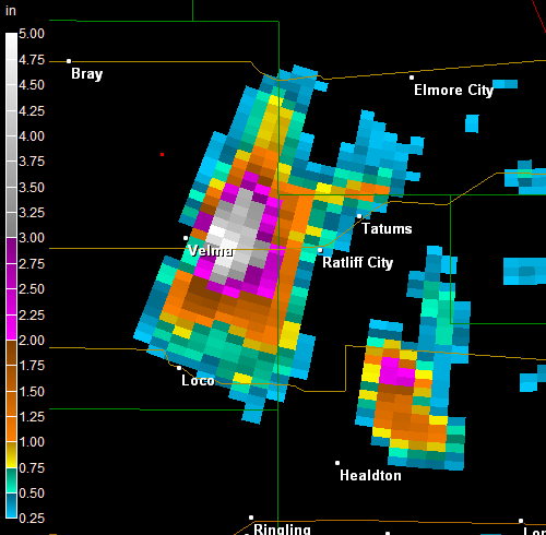
The MEHS algorithm pegs out at 5.0" (the bright white bins) to the east of Velma, OK. This enormous radar-estimated size is confirmed by an LSR of 5.25" hail two miles southeast of Velma, OK.
The researchers at the NSSL do excellent work on algorithms that identify and quantify severe weather using Nexrad data. Particularly interesting work is done by: